Cómo llegar
Por avión
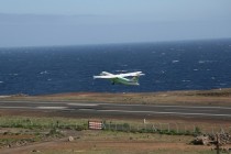
La Isla de El Hierro está comunicada con otras islas mediante la Compañía aérea Binter Canarias. Existen habitualmente vuelos con las islas de Gran Canaria, Tenerife y La Palma.
La duración de los vuelos es:
- Gran Canaria – Hierro: 45 minutos
- enerife Norte – Hierro: 30 minutos.
Los vuelos con la isla de Tenerife se realizan desde el aeropuerto de Los Rodeos (Tenerife Norte). Debe tenerlo en cuenta si su llegada a Tenerife se produce por avión al aeropuerto de Tenerife Sur.
Enlaces de interés:
getting there
By plane
The island of El Hierro is connected to the other islands by Binter Canarias Airline There are usually flights to the islands of Gran Canaria, Tenerife and La Palma.
The duration of flights is:
- Gran Canaria – El Hierro: 45 minutes
- Tenerife North – El Hierro: 30 minutes
The flights leaving the island of Tenerife take off from the airport of Los Rodeos (Tenerife North). Please bear this in mind if your arrival in Tenerife is by plane at South Tenerife Airport.
Useful Links:
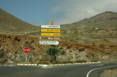
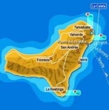
A la salida del Aeropuerto, ponga el cuentakilómetros del vehículo a "0":
Inmediatamente tras pasar bajo el túnel a la salida del Aeropuerto, dejará a su izquierda la salida a La Caleta. Continúe en dirección a VILLA DE VALVERDE, tras dejar a la derecha la salida hacia El Tamaduste.
Tras recorrer 3,3 Km, llegará al cruce con la carretera Puerto de La Estaca-Valcerde: gire a la derecha en dirección VILLA DE VALVERDE – EL GOLFO (Frontera).
On leaving the airport, put the vehicle's speedometer to "0": Immediately after passing through the tunnel to the Airport exit, take the left exit to La Caleta. Continue towards VILLA DE VALVERDE, after leaving the exit to Tamaduste on the right. After travelling 3.3 km, you reach the junction with the Puerto de La Stake-Valcerde: turn right towards VILLA DE VALVERDE – El Golfo (Frontera).
Tras entrar en Valverde, a 600 metros existe una desviación a la derecha: tome dicha desviación en dirección a EL GOLFO (Frontera). El cuentakilómetros marcará en ese punto 7,6 km.
600 metres after entering Valverde there is a turning to the right: take the turning towards El GOLFO (Frontera). The speedometer dial at that point will I ndicate 7.6 km.
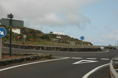
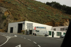
La carretera atraviesa los caseríos que componen los pueblos del Norte. Tras entrar en El Mocanal (y siempre sin desviarse de la carretera), llegará a una rotonda. El cuentakilómetros marcará 12,6 Km desde el aeropuerto. Tome la primera salida a la derecha en la rotonda, en dirección al túnel que le lleva a EL GOLFO (Frontera).
Iniciará una carretera en descenso hasta entrar en el túnel: a la salida se encontrará ya en el Valle de El Golfo.
The road passes through different villages in the North. After entering the Mocanal (and always without leaving the road),you come to a roundabout. The speedometer indicates 12.6 Km from the airport. Take the first exit right at the roundabout towards the tunnel that leads to El GOLFO (Frontera). The road goes downhill until it gets to the tunnel: it exits into the valley of El Golfo.
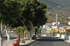
Siga la carretera hacia adelante sin tomar ninguna desviación: recorrerá una larga recta de varios Kilómetros seguida de un ascenso con varias curvas amplias, hasta entrar en una rambla urbana y llegar a un "Stop". Gire a la izquierda, y ya podrá vernos si mira en dirección a la montaña.
Follow the road straight ahead for several kilometers until you come to a gentle uphill slope with several wide curves and you drive into a wide avenue and reach a "Stop". Turn left, and you can see us if you look on the right towards the mountain.